Obando (Obando)
 |
It is 16 km away from the Philippine capital Manila and is part of Manila's conurbation which reaches San Ildefonso in its northernmost part.
Obando was likely originally called "Binuwangan" according to 18th century maps. In the 1734 map of the Philippine islands by Pedro Murillo Velarde, the places labeled "Vinuangan", "Polo" (currently Valenzuela), and "Maycauayan" were indicated separately and proximate to one another.
In the 18th century, the municipalities now known as Meycauayan, Valenzuela (formerly Polo) and Obando comprised only one town, the Municipality of Meycauayan. The town of Polo and Obando, formed a barrio called Catanghalan. In the year 1623, the municipality of Polo was organized which included the present-day territories of the Town of Obando. By virtue of a decree promulgated during the time of Governor and Captain General of the Archipelago, Francisco Jose de Obando y Solis, the town was created and separated from its mother town Polo on May 14, 1753. In the Governor's untimely death at the hands of the British during the Seven Years' War, the creation and establishment of the town was made and attended by the Alcalde Mayor of the province, Don Francisco Morales y Mozabe, the Provincial Minister, S. Gregorio, Rev. Fr. Alejandro Ferrer, together with numerous religious devotees. The minister who was chosen to administer the town was Rev. Fr. Manuel De Olivencia.
In 1907, Obando was made an independent town of Bulacan. Then through the untiring efforts of the municipal officials, a portion of Gasak, Navotas was reclaimed to form a part of Obando. The municipal officials, believing that this portion was once a part of the municipality but was adopted by Navotas in the course of time, effortlessly pushed through its claim to regain the area. The concerted action of all those concerned paid off when on January 30, 1975, by virtue of a Presidential Decree No. 646, a portion of approximately 1.78 square kilometers of Gasak, Navotas was returned to Obando. This is mostly fishpond and sandy beach and believed that when fully developed, this will serve as a good tourist attraction. By resolution of 1975 Municipal Council, the area was made into a barangay and named it Nuestra Señora de Salambao in honor of one of its patron saints.
Map - Obando (Obando)
Map
Country - Philippines
 |
 |
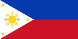
| Flag of the Philippines | |
Negritos, some of the archipelago's earliest inhabitants, were followed by successive waves of Austronesian peoples. Adoption of animism, Hinduism and Islam established island-kingdoms called Kedatuan, Rajahnates, and Sultanates. The arrival of Ferdinand Magellan, a Portuguese explorer leading a fleet for Spain, marked the beginning of Spanish colonization. In 1543, Spanish explorer Ruy López de Villalobos named the archipelago Las Islas Filipinas in honor of Philip II of Spain. Spanish settlement through Mexico, beginning in 1565, led to the Philippines becoming ruled by the Spanish Empire for more than 300 years. During this time, Catholicism became the dominant religion, and Manila became the western hub of trans-Pacific trade. In 1896, the Philippine Revolution began, which then became entwined with the 1898 Spanish–American War. Spain ceded the territory to the United States, while Filipino revolutionaries declared the First Philippine Republic. The ensuing Philippine–American War ended with the United States establishing control over the territory, which they maintained until the Japanese invasion of the islands during World War II. Following liberation, the Philippines became independent in 1946. Since then, the unitary sovereign state has often had a tumultuous experience with democracy, which included the overthrow of a decades-long dictatorship by a nonviolent revolution.
Currency / Language
| ISO | Currency | Symbol | Significant figures |
|---|---|---|---|
| PHP | Philippine peso | ₱ | 2 |
| ISO | Language |
|---|---|
| EN | English language |
| TL | Tagalog language |


